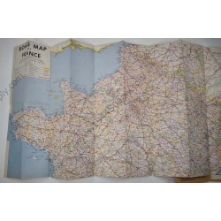
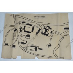
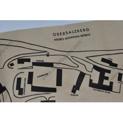
Map of Obersalzberg, Hitler's mountain retreat - Quick view
Map of Obersalzberg, Hitler's mountain retreat. Small map that was handed out to GI's visiting the site. It measures about 29 x 21 centimeters. The map was printed on low grade paper and not many survived. It was most likely printed in 1945, apparently for use of the first US soldiers who...
€125.00